Thursday, June 30, 2016

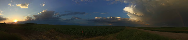
June 29, 2016 - Cass and Clay County Chase

Yesterday was a fairly impromptu chase.  I've been going to work every day and then pretty much crashing at home while I continue to fight this nasty summer cold.  When I saw the storms starting to pop and lots of little boundaries out there, yep, it was time to head out.

One of the first things I noticed yesterday was the really nice wall cloud just north of Fargo.  Thought I'd go out and get a look!


Really nice wall cloud!  It was fairly high based though, and most of the storms would be because we had Temperature/Dewpoint spreads of over 25 degree.  (T/d spreads as we say in weather lingo) 


Here's another shot of the wall.  We actually had two storm cells paralleling each other, so it made for some very cool photos and backgrounds. 


I waited around a little and then as the cells kept moving to the southeast I started to make my way across the bridge by Oakport.  

I've had a few people over the years ask me why I don't like chasing in metropolitan areas.  Well, the reason is simple.  Too many people, no options, and no lines of sight.  It can be very dangerous even to chase in little small towns.  Once you lose your lines of sight, then you lose your vision of what the storm is doing right now.  Yes, we have all these tools of radar and satellite and everything, but those images are the past.  It takes 5 minutes on average for a radar image to get updated.  So, by the time I see it parts of that radar image may be 5 minutes old.  That's why chasing rain-wrapped tornadoes and storms at night are so dangerous.  

Once I was finally on the Minnesota side I went to to near Georgetown and saw some really interesting cloud formations.  Non-tornadic, but it could definitely fool the untrained eye.  

Pretty shot of a cloud base over Clay County 11
After this, I saw some of the most vibrant rainbows I've seen in years.  


Horizon to Horizon

Farmer's dream...

Mini-Mammatus
I was then treated with one of the most spectacular sunsets in a long time....
Minnesota Sunset
Non-severe storms, but most certainly one of my most enjoyable chases of the year.  There wasn't ever a rush to make sure I'm in the right position, camera is always where it needs to be, no hail cores to worry about, etc.  Just a relaxing chase, which I know to many sounds like a contradiction in terms as there is an expectation that chasing is always 100% adrenaline.    Now, while I did have some adrenaline pulse though me when I had a cg pop a -tad- too close, for the most part it was a very relaxing chase.  We also took an opportunity to do a beta test of the new video streaming system, and it worked seamless!  Look for it VERY soon! 

Now, we start entering the heart of summer.  We start to see the corn really grow (knee high by the 4th of July, right?) and the rest of the crops come in.  On the down side, we also start to see the sun set a little earlier each night, but that just means we should just enjoy nature a little more and hold on to that last little bit of daylight as long as we can.  

Tomorrow is Canada Day for our friends north of the border, and then in just 3 days after that, the 4th of July is here.  My plan is to enjoy some Timbits tomorrow and then hopefully by the end of the day I'll be relaxing with my family.  Take the time to enjoy the summer - we're too busy as is.  If your son or daughter wants to toss the ball one more time or try for 'just one more' fish, do it.  You might not remember that next ball which they don't catch or that last fish which just happens to pop off the hook as you're lifting it out of the water, but 20 or 30 years later I can guarantee they will, and that's something more precious than any tangible item.  It's a memory. 

Have a great Canada Day and 4th of July everyone!

Sunday, June 26, 2016

June 3, 2016 - Cass County Chase

Seems like many of our chase days so far this year have been on Fridays.  This is kind of a two-edged sword.  On one hand I'm glad because it's a Friday and if I get stuck somewhere then I don't need to worry about getting sleep and getting up in the morning.  On the other hand, it delays me starting my weekend and spending much needed time with my family.

But, this chase was over with fairly early, which made it all the better!  Now, one thing I will note is this graphic below:
160603_rpts Reports Graphic
Where are the severe reports in ND?

Yep.  We had zero severe reports in ND.  Donut.  Zero.  Nadda.  Zilch.  Not even a wind report.
However, earlier in the day we knew there was a chance for some severe storms in our area because there was a low level boundary along with the upper level low forming as well.  Combine that with low freezing levels, there was a chance we might see some hail reports and _maybe_ a tornado or two.

We started off watching some storms just south of the F/M Metro.  Our promotions director (who recently won an award for her work, so everyone say CONGRATULATIONS WENDY!) also met me out there to shoot some b-roll for some promo work tagged along in a separate vehicle as well. 

Neato!  Look at the patterns and scud!  It had good motion into the cloud base as well. 
We started off watching this cell near Colfax try to go up.  We could see the back of the towers and it was looking pretty crisp and clean, and with another cell off to my west, this was a good place to watch both cells at the same time.  No reason to run around the countryside when I could just park on a dirt road watching storms.  

Here's what the cell west of Walcott looked like.  Nice rain core with a twinge of green. 
We kept watching these storms for a while.  We knew the chance of anything happening was low, but we wanted to watch anyways.  

Here's some timelapse footage from the one of the cells as it passed over us. 

Nice Panoramic again.

Wendy and I kept watching these storms for a little while and then they started to fall apart quite rapidly.
HI WENDY!
  I crack myself up. :) 

With these storms starting to fall apart I started to pay very close attention to the cells that were starting to move out of Grand Forks County.  Wendy ended up heading home and I made my way north.  

I'm glad I did.  What I found did not disappoint!

Supercell anyone?  Near Galesburg, ND
Just amazing structure with this storm!  I was on the phone with Hutch back at the station very quickly letting him know what was going on.  

Oh wow. 
The structure of this storm very much reminded me of the Leonard, ND storm from August 2006.  The striations in this storm, the inflow feeding into it, and then the wall cloud associated with this.  I was just hoping it would hold off on producing anything until it got away from Arthur and Hunter.  


Yep, this storm was definitely taking on that supercell shape to it. 
Rain and hail off to the right.  At this point the leading edge was almost on top of me. 
The good news for me is that the storm was moving fairly slowly off to the east-southeast, which made it easy to keep up with. 

Right over Arthur I believe.  Look at the striations in the clouds with the green hail core off to the left.
For a little while it looked like it was gusting out, but it very quickly wrapped up into a very nice wall cloud. 

Inflow feeder band off to the right, slight RFD punch coming in.  Rain and hail off to the Northwest. 
It was around this point that I called the NWS after putting Hutch on hold back at the station.  (Sorry boss!) I was able to talk with one of their forecasters, Jennifer, and her and I had a very long conversation over what I was seeing visually and what she was seeing back at the office in Grand Forks from the 88D and the near storm environment maps. 

Stacked plates. 

Not looking as organized. 
This wall went through several cycles.  The part which was concerning to me is that this wall cloud was spinning and it was fairly low to the ground.  That's never a good sign when you do not want a tornado to develop. 

Leading edge coolness. 

Cycling again. 
As I got closer to the Interstate it started to fall apart as it got off the boundary and the near storm environment became less conducive to storms.  It did have a couple of weird features as it started to fall apart though. 

Is that what I think it is?


Enhanced in Photoshop.  Notice the direction of the trees and where the wind is coming from.  
Very neat storm. 

One last shot before heading home. 
Here's some of the video that I shot of the storm.  Every once in a while you can hear me typing and talking to either Hutch or the NWS on the phone.  


It was a very good and photogenic storm.  It's been hard to find these this year - most of the storms have been large rain producers which makes it much more difficult for us to find structure.  It also makes it much more harder to safely see what is going on inside the storm from a spotting/chasing perspective.  This really has been the most picturesque storm of the season so far!   

I've heard some chasers from around here say this year so far is a 'bust'.  Yes, we have not had the June 17th, 2010 or the other major outbreaks like June 27, 2015 days.  But, I'm OK with that.  This so far has been a very productive year and the good news, no loss of life and no major crop or flood damage.  Yes, it's still a little dry, but that's improving and the lake levels are finally starting to rise. 

The next week looks fairly quiet with some chases for showers and thunderstorms later in the week, but no major severe weather outbreak look to be on the horizon.  Thus, I'm looking forward to hopefully spending my time with my friends and family over the 4th, getting my fishing line wet, catching a few walleyes and having shore lunch while we watch fireworks.  Even with all the bad things happening in the world, it's still a pretty good place where we can enjoy many freedoms, especially here in America, where in many other parts of the world people do not have. 

I still have a few more blogs to get through of the smaller events we had (Including the Moorhead day with Krista Boehm!) but I wanted to get some of the more pic-heavy blogs out of the way first.  

Whatever your plans are for the 4th, make it a safe and happy one.  

Now, back to my cold medicine!  (I blame any typos on Nyquill!) 


Skandia, ND (Barnes County) 5-10-16

5-10 is the first real "chase" day we had here around the area.  We knew it was going to be a day where the chance of anything going severe would be slim to none.  However, we used it to try out some new gear and fix a few things, like our position tracking that we are doing so Hutch and everyone back at the station know where I am at and can overlay that position over our radar we use on air, etc.  We were also still waiting on some new gear (4K anyone?) and so it really was a dry run for us at the station to work out all the kinks and make sure in a real event everything worked as planned.

No real chase blog here or story to go with it, just going to toss up some pictures from near Skandia Township.  Most of the photos are all from my phone or table that I use during the chase.

Hope you enjoy!

Pretty clouds....

Ever since I found that dang panoramic option on my phone....
You know I'm all about that base, no trouble....


Leave it to beaver...tail, that is!


Some new livery for one of the Storm Team vehicles.  
"Tower, come right 180 degrees, increase instability and shear, then contact Fargo center on 11.1. " 
Overall, just a fun little 'jaunt around the block' as we like to say.  Home in time to watch the news and get a good night's sleep.

On to the next chase!


May 22, 2016 LaMoure and Dickey County ND

It's been a long, and cold winter.

Anyone care to take a dip?
  
As I sit here dealing with a nasty summer cold I figured it was time to update my blog.  Now, though, spring has sprung and the storms have made their appearance north of I-80 and we're seeing much needed rain across the valley.  I know it's been a little while, and even here in June, there's still portions of the southern valley that could use a little moisture.  

This year with chasing we've made a few modifications and changes as we do every year.  Some you can tell, others are changes behind the scenes.  The biggest thing is that the video I'm feeding back to the station will be in high definition this year.  It's not using the pure cellular technology I have been using, but it's something with a little more kick and signal strength!  I'm sure you've seen it already this year when we were able to feed the video of one of the tornadoes near Barry, MN right at the end of the 5:30pm newscast and then when we were feeding the video from the mean looking wall cloud near Arthur, ND back on June 3rd.  

I know many of you watched my feeds in the last few years via the TVN Weather app and trust me, we've heard very loudly that you want to be able to see it again.  We are working on it and we hope to have something for you very, very soon!  As soon as we have the stuff signed, sealed, tested, and delivered, we will have it up!  My question for all of you is how would you like to see the live video feed?  

1.  VNL Weather App/VNL News App
2.  Via YouTube
3.  Web site link on VNL web page/some other web page. 

Also, what about audio?  Any preference for audio?  Normally I don't have it on for one of two reasons - 1.  I like jamming to music while chasing, 2.  Sometimes we talk about stuff and the occasional naughty word slips in.  :) 

If you have other ways you feel passionate about how you want to view it, please let us know!  We want to make sure you have access to the video and position in the best way possible.  Speaking of positions, if you've watched any of our severe weather cutins so far this year, you can now see where Hutch, Robert, Lisa, or Justin are able to overlay my position right onto the radar map on air!  

I'm guessing you aren't here now to just read about the other stuff we have done (upgraded radio for communication, upgraded other camera gear, (4k anyone?) and some other geeky stuff.  Let's get on to the chase pics! 

This was a day which was going to be non-severe for our neck of the woods.  Most of the tornadic and severe weather potential was going to be far to the south along the dry line in Oklahoma, Kansas and Texas, while a secondary threat would be up here in the northern plains in parts of southern and northern SD.  That's pretty close to how the models progged it out, and the results were similar.  

I was lucky and I had Robert Hahn with me this day.  (Make sure you check out his blog over at http://www.valleynewslive-ondemand.com/blog/2016/05/23/dust-in-the-wind/)  for some of his pics.  One of the best parts about chasing is when Robert is able to come along for the ride.  It's always helpful having another weather-mind in the car, helping me forecast, find roads, help with communication back to the station, etc.  

Some clouds and a bird near Tower City, ND. 
Our first stop was near Tower City, just on the edge of Cass County.  There's a few exits along I-94 and I-29 which if you live near, you can many times see me stop and just check things out.  It will offer me paths to where I need to go, and it tends to be a little out of the way, but still offers many great vantage points and gives me great road options.  I know some of the troopers from NDHP and the local county sheriffs have stopped me a time to two and looked at radar data with me and just talked shop and weather.  It's a great thing because these are men and women who are out there doing a very tough job and anything I can do to help them out is good - it helps to keep our communities safe.  

Another shot of a rain shaft. 
 Soon after Robert and I started to watch the storms coming out of Emmons and Burleigh Counties and make their way towards our viewing area.  After a quick fill up, it was time to hit the road again!  Robert and I ended up off to ND 13 somewhere I think and ended up just watching the storms come to us.    


Taken around 7:20pm
With this storm we knew we were getting close to the end of daylight and it was severe warned, so we just let the storm come to us.  

Nice big shelf!
We knew the chance of us getting a spin up here would be slim to none, but had some awesome pictures anyways!  

Wait, did we say no spin ups?  I mean, uhm.  err....uhh. 
Lots of rising motion under these clouds.  A couple of times I know Robert and I were talking to each other going "Ok, watch the cloud motion....is that a leading edge vort, or is it something different?"  Most likely good Skywarn material from today.  

DUST STORM 2016
We also knew many fields were just planted and that the dust would be an issue.  The dust would make things even more look like we were going to have spin-ups, even though we knew that would not be the case. 

Nothing like some CG action behind the shelf!
We started to have to move off to the east after sitting here almost 20 minutes.  

Dust from the outflow of the storm.  Not a tornado. 
We kept seeing these cool looking dust bombs from the leading edge of the storm.  At one time we had a little dust whirl spin up just to our south, but as it was getting dark it didn't turn out very well.  

Dual dust areas!
Shelf action with dust underneath might make you think tornado, but no. 
As it got later in the evening, I did end up having to adjust my camera more and more in order for us to make out the features of the storm.  

After playing leapfrog with this storm for around an hour, it was time to start making our way back to Fargo.  Both Robert and I had to work the next day, and we knew the storm was losing it's intensity and with not much for lightning, seeing any structure would be hard.  

One more shot, then home. 
Overall, a good chase.  A few more miles on the StormTeam vehicle, and then in bed by 10:30.  Can't really beat it! 

Even though this is only the second chase of the year, many more updates are on their way! As I sit here writing this up at the end of June, I think I have 4 or 5 more blog posts to write about for chasing this year!  

Make sure you let us know how you want to do the video feed!  Comment below or on Facebook/Twitter! 

See you out there on the plains!  


Wednesday, July 29, 2015

July 17th Britton, SD to Madison, MN chase

Just a warning, this post is fairly pic intensive!

Yet another great day for chasing!  This day started off with me knowing I needed to end my night either at home in Fargo, or out somewhere in Otter Tail County for a family reunion.  Well, I made it to the family reunion, but I was just a tad late.

After leaving Fargo and heading south as fast as I could, I realized we were very capped off in SE ND.  I consulted with the Ministers of Ministers and ended up in NE SD.  We could see the towers going up, and we were starting to get some returns on the ABR (Aberdeen radar).  I had to make a decision - how do I want to attack this developing storm near Britton, SD?  I attack it from one way, there's a good chance I end up in tennis ball size hail.  I attack it the wrong way, and I end up seeing nothing.  So, I decide to attack it head on.

After driving west out of Lake City I ended up just a few miles east of Britton, and boy was I in for a treat.

Why, hello there!

I took over 50 photos of just this wall cloud and feature.  Here's a few more shots:


Shortly after this, the storm started to really get the inflow going.  I could feel the warm air at my back rushing towards the storm.  That was when things got...interesting!

Bowl like feature off to the left? Yeah.  That is what you think it is. 
The wall cloud was just scraping the stuff up off the ground.  You could just see the precip almost get sucked right up off the ground and get pulled in.  It was rapidly spinning at this point and would not shock me to find some damage from it.


I just could not stop taking photos of it.  At some point though, I knew I would have to leave as this wall cloud was starting to dissipate and a new one was starting to form and take it's place.  This is where the new action area and possible tornado would form.  I also knew from spotter reports there was some very large hail being reported with this storm, which I wanted none of as I like my windshield intact.

At this point I moved to the east, making sure I was staying ahead of the hail core or trying to stay in the inflow notch, as the chance for hail and being in the right position to see something spinny would be the best. Being able to do things like this only comes from experience and training, so please, don't try this at home.


Rain and hail core.  Yes, it was loud. 

Hail core to the north of me. 
Looking more outflow dominant...or is it? 


Yummy. 

OH HAI THERE! 

Edited this photo a little so we could see what is going on behind the rain/hail. 
Soon, the new wall cloud started to form and it got it's act together quickly and the storm stayed tornado warned.  I knew I'd need to get east, as the large hail reports continued. 


Just a cool cloud formation along the leading edge...right? :) 
I see the tour groups from COD around, so it was pretty near to know I'm probably in some tour groups photos.  That, and it's always fun to run into.  COD really does a great job educating and taking people on safe tours. 

WHO IS THIS GUY?  I MEAN, REALLY?  SAME ROAD? :-) 
I run into a few other chasers along the way, which was always fun.  I wasn't able to really stop and say hi and gab, as I was very busy getting live footage up to the networks and doing phone cut ins.  So, if I seemed short to some of you out there, I apologize as I was just a _tad_ busy.  

Yikes.
Yikes is a good way to put it.  You could almost feel the hail coming down, instead of the roar.  Every once in a while a golf ball or greater sized stone would come flying out and I'd be greeted with a familiar 'TONK!" on my roof or I'd see it explode on the ground around me.  I knew it was time to get east.  As I made my way east, I also ran into THE Doug Kiesling.  Something about a fireworks and a dirt road comes to mind.  (Inside joke.)  This cell was also Tornado warned (radar indicated) and it would be making a beeline for Sisseton.  I needed to get east...and fast! 

Wall cloud/area of concern is off to the left.  
I made it into Sisseton and parked myself down a little road where I knew I could get out.  I needed to also plan my roads smartly and quickly as I knew very large hail was coming for Sisseton, and I needed to deal with the road network and the ultimate decision - do I go south on I-29, or do I continue to jog east and hope the hail core stays far enough north of 10 to where I don't turn into a gigantic while golf ball.  

As I was heading east out of town I could see the large hail stones falling all around me.  I could also feel every larger stone as it hit my truck.  I knew as I was heading east south on I-29 toward Peever would be my choice.  

Sisseton under the hail shaft right about...now. 
I headed south, took one quick look back, and I could see something trying to make it's way out of the clouds and wall cloud area.  I never saw anything touch the ground though. 

It was also around this time Bill Doms and I ended up chatting on the phone quite a bit while we tried to figure out our attack plan.  I know that Nick and Amanda were making their way towards Ortonville to see shelter from the bow echo which was forming.  I went down by Corona to Wilmot and was greeted with some of the best Stacked Plates I've ever seen. 


Oh, yeah.  Notice the storm off to the left.  That's the next cell coming at me which I would have to deal with!

Just incredible...

I tried to warn her....
Just incredible shots. 

At this point, I was making my way down dirt road after dirt road.  The good news most of the really nasty dirt roads (including some minimum maintenance!) were still in decent shape as they hadn't been hit by the rain and hail yet.  

I kept making my way south and east, but at some point I would have to face the beast and let it overtake me so I could make the final long journey home.  I knew there was no way I would make it to the family reunion tonight.  

I made a few phone calls and after talking to some friends and Hutch back at the station, I ended up finding out about a car wash in Madison, MN.  This is where Bill and I would meet up, get some gas, and then ride out the storm.  

Bill and I ended up riding out the storm, and just before the storm hit, it looked like this: 

Mommy.
We expected to get hit with 70+ mph winds, so we set up our cameras and proceeded to watch the town of Madison get hit by the storm.  We saw the town lose power fairly quickly, but it seemed like the worst of it went just south of the town.  

Bill and I were both able to escape the storm with no damage, aside from a bent Ham Radio antenna, and said our good-byes and started to make our way home - him to Minnesota, myself to Fargo. We were able to chat on the phone for the first hour or two, which is always a welcomed thing.  You know you have a good chase partner and friend if you have someone willing to gab with you about almost anything to help decompress after a chase and to help keep you company on the often times long drive home.  

I ended up getting home right around 1am, after a stop at McDonalds for yet another Minion toy.  (Did you know I have an unhealthy obsession with Minions?) 

I have a few pano pics which didn't make it into the full set from earlier. Here they are in no particular order: 


Overall, a very awesome chase, and a great way to end a day. 

I made it out to the family reunion on Saturday morning and ended up out in my boat for a good portion of the day.  Good times with family, some fish in the fry pan, all said - a pretty good weekend.  And really, isn't that what this is all about?  That said, don't skip out on your family reunions.  Yes, we all have the crazy Aunt/Uncle...but you know what?  You're still going to miss them when they're gone.  Find out about their lives growing up.  You might be surprised about what you find out!